Saturday, July 3, 2021

The Lilac City - June 29, 2021

 Of course we arrived in Spokane at the beginning of the Historic Heat Wave. What are you gonna do?

You’re going to get up really early and do your walks before it gets too hot. So we did get up very early, and it was already really hot. The worst of both worlds. But it just kept getting hotter as the day went on, so every minute counted.

South Hill Parks

For our first walk, on June 29, we chose the South Hill Parks walk in Spokane. Because we started in the parking lot and not in the grocery store, we missed the first turn and walked about 1 km in the wrong direction before realizing it. Then 1 km back to the turn. And the sun was getting higher.

The correct turn involved crossing a very busy street at a point where there was no light or crosswalk. We entered a spectacular neighborhood full of gorgeous, but not over-the-top, houses. The streets were wide and the houses were far apart, and each house was different. I could have taken a photo of each one, but it was too hot too fuss with lots of photos. Here are just a few:

Pleasant Craftsman style house

Ken was very impressed by the workmanship that went into this Little Free Library. Many of the LFL’s here contained food and books, or just food.

Another Craftsman lovely

We headed to Manito Park, at the edge of this neighborhood. It was a 90-acre park, botanical garden, conservatory, arboretum, and more. It was designed by the Olmstead Brothers in 1913.

Duncan Gardens, in Manito Park. Conservatory in background.

After walking through the Duncan Gardens and the Rose Garden, we found the directions too difficult to follow, and we missed seeing the Japanese Garden, the Lilac Gardens, and the Mirror Pond. We later learned from a local that the Japanese Gardens were being remodeled and were closed. That was very disappointing because we love Japanese gardens and I was really looking forward to seeing this one.

On the way back to the start point we passed through another section of the South Hill neighborhood. By this time it was getting quite hot and all that mattered was getting back to the supermarket where we started. However, I couldn’t resist stopping to take a photo of this charming display in somebody’s front yard.

For the Record

Later in the day we drove out to a mall. It was brutally hot. Here is the proof:
Historic Heat Wave

Volkswalk Rating

Walk Route: B-
Points deducted for dangerous crossing of 29th Avenue at beginning

Walk Instructions: F
  • Got lost at step 1 because we exited the parking lot at the corner, rather than the center. 
  • Step 2 was dangerous and unacceptable. You should never be instructed to cross a busy street like 29th Avenue unless you are crossing at a traffic light or crosswalk.
  • Got lost at step 8. Very vague directions. Finally found the Rose Garden. 
  • Step 10, “Cross” the Rose Garden. This was totally confusing. “Cross” suggests going through something to the other the side, so we walked to the far end of the Rose Garden. We could not see the  Rose Garden on our map. The bright sunlight washed out the colors. 
  • No luck at all with steps 11 and 12. We never found Nishinomiya Road. This made it impossible for us to find 13 and 14. Somehow we stumbled back onto the route at around 15.  Please provide more detailed directions for steps 10-14 so that someone who has never visited this park would be able to follow the directions.
  • It is our understanding that the Japanese Gardens have been closed for over a year. A detour really should have been provided.
  • Please consider providing a small, readable, labeled, inset map of the park.
  • It would have been helpful to be told which side of the street to walk on in the neighborhoods. We found ourselves constantly switching sides when the sidewalk vanished or when we had to turn.
  • It is always helpful to have the number of blocks between turns specified. It would have prevented our having to walk for 10 or 15 minutes past our turn in the blistering heat.
  • It is always appreciated when each kilometer is indicated in the instructions, so you can gauge your progress.


Monday, July 10, 2017

June 20, 2017 - Pierre, SD (YRE 768)

The plan was to meet Kate and Marty at the Visitor's Center in Pierre, SD at high noon. We would be driving in from Rapid City in the west, and Kate and Marty would be driving in from Mitchell in the east, and we would meet in Pierre, which is practically in the center of the state, on the east bank of the Missouri River.

Before we get any farther, please know that it is pronounced like PIER or PEER, not PEE-AIR.

We had nearly a 3-hour drive so we left at 9:00 am. We passed through Cottonwood, SD, population 9. There was a lot of infrastructure there for that size population.

Around 10:10 I got a text from Kate saying they were in Pierre. And she had some interesting factoids. Pierre and the eastern half of South Dakota are in the Central Time Zone. Rapid City is in the Mountain Time Zone. The dividing line happens to be the Missouri River. Who knew? Certainly neither one of us knew. You learn something every day. Such a covfefe.

In my defense, I will say that it is not something that is obvious on the map of South Dakota in my road atlas. You can barely find the time zone line even when you know it's there. And, while there were probably close to 100 signs warning us that we were approaching Wall Drug (more on that later), there was nary a one warning us that we were approaching another time zone. There was a very small sign on the bridge over the Missouri that informed us of the change, but it was too little, too late.

The Missouri River, from the Central Time Zone side[/caption]Kate and Marty managed to amuse themselves for the 90+ minutes until our arrival. Upon arriving at the Visitor's Center and reiterating how surprised we were by the time zone line just a stone's throw away, we embarked on the mission of the day: the Pierre volkswalk. As of this trip, Kate has visited all 50 states. This is her 48th state capital volkswalk, and my 40th. Other people (i.e., anyone reading this) may not care, but we care.

So, here's the deal. Pierre is very small (pop. 13,646 in 2010) and not very exciting. Sorry folks, but it just isn't. We did our 5km walk and got out of there as fast as we could. Here are a few pictures.
The Hughes County Courthouse, finished in 1935, in the Public Works Administration Moderne style (I did not make that name up)
The South Dakota State Capitol, completed in 1910. It is based on the Montana capitol building.

Inside the rotunda
Interior of Capitol
The South Dakota Supreme Court is also located inside the Capitol. It was closed, but we peeked in through the glass in the door. There is a very unusual mural behind the bench. At first I thought it was a religious painting, but it is not. It is called Mercy of the Law and shows an angel guarding over the legal process.

"Fighting Stallions" was commissioned to commemorate the loss of the Governor and seven other SD leaders in a 1993 plane crash
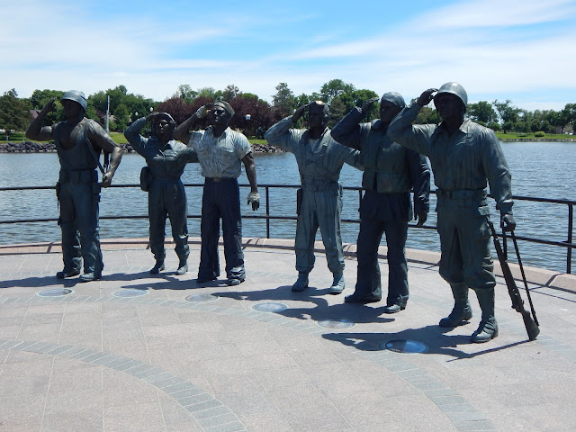
Memorial to WWII soldiers
At least there is a quilt shop here! And a buffalo!
Along the banks of the Missouri we found a little cabin that has been used by Girl Scouts since 1929.  Sweet!

On the way back to Rapid City we stopped at Wall, SD, to see the famous Wall Drug Store: 5-cent coffee, free ice water, homemade pie, T. rex, rocks, Western wear, and so much more. Who can resist such cheesiness?
Walk Route: B-
Walk Instructions: B-

Monday, June 19, 2017

June 19, 2017 - Cheyenne, WY (YRE 0002)

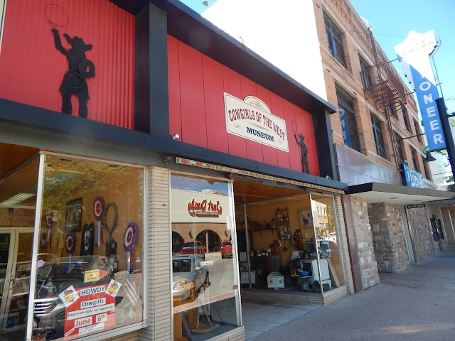
The Cheyenne 5km walk started at a very nice "Western wear" shop, pictured below.

This walk was very hard for me. I had not realized that the elevation of Cheyenne is 6062'. I felt lightheaded and lead-footed. It was also hot and dry, and I felt dehydrated the entire time, despite trying to drink lots of water. And then there was my lack of sleep the last night, and achy joints, a side effect from my migraine medicine taken yesterday.

Cheyenne is a small town, population about 60,000. It's pretty clean, but it's old and bland, though they have done a good job of historic preservation in some areas. Here are some of the highlights.
This museum was closed when we walked by


Big Boy is one of eight oversized locomotives built during the 40's. It weighs over one million tons and is so long it is articulated to go around curves.
 

The depot
The centerpiece of Cheyenne is the Capitol building. Unfortunately for us, the building is undergoing renovations and it is not only closed, but surround by a fence. It also looks like they are building more office buildings around it so you won't be able to see its glorious dome from all sides for much longer.

The checkpoint was covered in plywood due to the construction

To make up for not going inside the capitol building we went into the supreme court building, mainly because I needed a bathroom. (Remember the water?)
The Supreme Court and Law Library
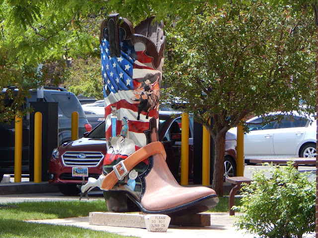
One of the fun things about Cheyenne is the series of painted cowboy boots scattered around town.
"Outlaws of Wyoming"


The salmon makes this my favorite
After completing our walk we hit the road because we had a 5-hour drive to our next destination. On the way we drove past Lost Springs, WY - elevation 4996 ft, population 4. Oh, give me a home . . .

Walk Route: B-
Always nice to see a capitol building.

Walk Instructions: D
No map. Some confusing parts, especially at the lake.

Friday, September 30, 2016

September 30, 2016 - Leavenworth, WA (YRE)

You could wear lederhosen or a dirndl to do a volkswalk in Leavenworth, and you would not look ridiculous. Every single building in Leavenworth looks like it was transported here directly from Bavaria. This place is Over-The-Top Cute.

We started our walk at the Icicle Inn after enjoying our first look at Leavenworth as we drove through town to the start point.
We passed several Alpine-themed hotels with gorgeous flower boxes and several buildings with murals that kept to the theme.


Pizza delivery, German-style.

Upon reaching Front Street, we entered the really touristy part of Leavenworth. We strolled through several blocks of Bavarian shops and restaurants, stopping to buy some delicious imported mustard. We heard polka music and thought it was being piped in until we arrived at the bandstand. There was yodeling, too.


A Maypole?


When we reached the Festhalle the street was blocked off and they were setting up for Oktoberfest (of course).
We bypassed this area and followed some back streets to a trail that followed the Wenatchee River upstream toward Riverfront Park. This was quite a change of pace, but not unwelcome. We followed the trail (which is a XC ski trail in winter, past a playground and over a bridge, where we admired the crystal-clear water and the steelhead hanging out in a shady part of the river. The trail continued to Blackbird Island, a peaceful spot just a stone's throw from all that Bavariana.

About this time we remembered passing the Munchen Haus and we were feeling a bit hungry, so we interrupted our walk to have some lunch. The Munchen Haus has a limited menu but a well-deserved reputation. They serve several different types of sausages, several mustards, sauerkraut, pretzels, and German potato salad. And several types of beer plus one type of cider. Real health food, ja? It was quite tasty, and the guys especially enjoyed our lunch. It was hot so I gulped down my cider and I got pretty buzzed. I made an executive decision that we were doing the 5km walk, and we just had to get back to our car to complete it.

Munchen Haus


On the way back we passed a boutique that lured me in and I bought a necklace. This is so unlike me. I was still pretty buzzed. I have never felt a buzz from cider before. I guess I never had German cider.

Walk Route (5km): B+

Walk Instructions: B
The map isn't the best. Grab one of the free tourist maps that are everywhere, and you will always know where you are.

Just before you get to Leavenworth you will come to a nice fruit stand/quilt shop. We had to stop. Oh, the apples!

Thursday, September 29, 2016

September 29, 2016 - Ellensburg River and City Parks (YRE 11151)

Irene Rinehart Park lies next to the Yakima River. We started out on a pretty trail among the trees.
We could see people fly-fishing in the river. We passed a small waterfall and enjoyed the sound of the rushing water. 


We saw about a dozen signposts that had been recently installed. They promised that "Circle the City" would be coming soon. The sooner the better. This trail really needs something to make it more interesting.

Although the vegetation was quite dry, we did see a lot of hardwood trees, and they provided some welcome shade on the first segment of the walk. We saw an abundance of white berries. I believe they are snow berries. They are probably not edible, and they don't look very appetizing, anyway.
Judging by the prodigious number of rose hips, this would be a wonderful walk when the wild roses are in bloom.

Soon the river got closer to I-90 and the park became a narrow strip of land between the two. The sound of rushing traffic replaced the sound of rushing water.

There is a flood control project in this area, and we had to walk over a "watergate."

The water looks so harmless today, but there has been flooding here within the past couple of years.

When we reached Carey Lakes our trail went between the lake and the river and we got farther away from I-90 for a while. 
At Carey Lakes:

We had our first problem with the instructions at this point. I misunderstood what the "green metal gate" was and basically tried to follow step 9 too soon. We missed a little bit of the trail as a result, but I don't think we missed anything very interesting.

At the far end of the lake we found a "Frolf" course.

As we came around the lake we reached a point where the path took us under I-90. At this point we found a solar array. (This was the turnaround point for the 5km walk. We opted for the 10km walk and kept going.)

We walked along a dike, part of the Reecer Creek Flood Plain Restoration Project.

Eventually we reached the Rotary Park Sports Complex - soccer fields, baseball fields, and some basketball courts. Everything was clean and well-maintained, even the restrooms.
For recycling:

We passed through West Ellensburg Park, a city park. It was adjacent to Rotary Park. From there we walked for about 6 blocks through a run down neighborhood where we provided entertainment for various dogs who considered us to be intruding on their territory. Then we returned to Rotary Park and continued back to the path under I-90.

As we emerged on the other side we ran into some more problems with the directions. We didn't understand step # 26 and thought it must have had a typo in it, so we went LEFT instead of RIGHT. It worked out ok, because you really can't get very lost here. We returned to our car using an alternate trail along the river, in accordance with the directions.

If you decide to do this walk, be sure to bring some water with you. I drank almost all of my water during the walk, as it was a warm day and abut 3/4 of the walk is out in the open.

Walk Route: C

Walk Instructions: D
Got lost twice. In addition, I think step 16 is incorrect.